- Log in to post comments
<Return to Acidfree Albums> <Return to Maps> <Return to Historical Maps of Mexico>
Image

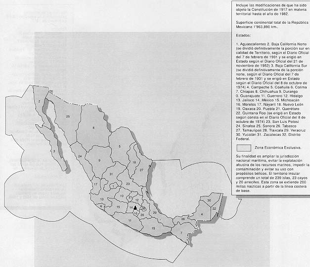
State borders as of 1982 with Quintana Roo and Baja California Sur as states and demarcating exclusive maritime economic zone.